Sun-burned Land
Reseach/ Counter mapping/ Video instalation
→ See The Exhibitin in Tettem, Curated by the Hackers&Designers
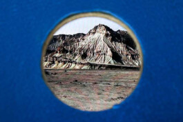
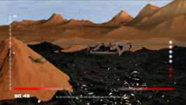
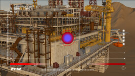
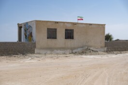
Sunburned Land is a video installation derived from research conducted in the Strait of Hormuz. The research explores the subjective mapping methodologies and their evolution as an opportunity for societal engagement, collaboration, and revisions. Through the simulation of concealed geographical attributes and their integration with narratives recounted by local inhabitants during interviews and collaborative sessions, we traversed the iconic landmarks of the region, creating digital documentation as a counter-narrative to the state's dehumanized representation of the area. This empirical and participatory research is accessible to the audiences through visual storytelling, using footage of obscure landscapes combined with 3D models of the area and visual symbols from folklore tales. These symbols embody the history, culture, beliefs, and experiences that are shaping the collective identity of the region and resisting the state’s representation by providing decentralized knowledge. Additionally, The installation demonstrates how sensory experience and long-term exposure to the region are used as a method to gather spatial information followed by debates with the audience on the politics of representation. The ongoing evolution of this research has been demonstrated through various public talks, publications, and other exhibitions.
Published in → Hackers & Designers:
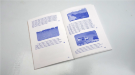
Network Imaginaries San Serriffe, Amsterdam 2021
→ Here you find the Published research
Exhibited in →Tetem Presentation space & platform for Digital culture
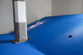
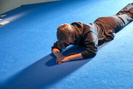
The design of the platform
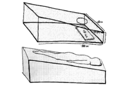
Lying down and looking at a holistic picture on a tilted angle engages the body and mind in an experience that brings us closer to feeling the contrasting tranquility of the island. (The tilted surface, at -6° to -24°, stimulates blood circulation to give a neutralising and numb-like feeling while looking at the screen). Together, the flying movement of the camera, the physical weightlessness and numbness, and the storyline create a bodily experience of a digitally narrated story.
Back to top ↑

Sun-burned Land
Reseach/ Counter mapping/ Video instalation
→ See The Exhibitin in Tettem, Curated by the Hackers&Designers
Sunburned Land is a video installation derived from research conducted in the Strait of Hormuz. The research explores the subjective mapping methodologies and their evolution as an opportunity for societal engagement, collaboration, and revisions. Through the simulation of concealed geographical attributes and their integration with narratives recounted by local inhabitants during interviews and collaborative sessions, we traversed the iconic landmarks of the region, creating digital documentation as a counter-narrative to the state's dehumanized representation of the area. This empirical and participatory research is accessible to the audiences through visual storytelling, using footage of obscure landscapes combined with 3D models of the area and visual symbols from folklore tales. These symbols embody the history, culture, beliefs, and experiences that are shaping the collective identity of the region and resisting the state’s representation by providing decentralized knowledge. Additionally, The installation demonstrates how sensory experience and long-term exposure to the region are used as a method to gather spatial information followed by debates with the audience on the politics of representation. The ongoing evolution of this research has been demonstrated through various public talks, publications, and other exhibitions.
Published in → Hackers & Designers:
Network Imaginaries San Serriffe, Amsterdam 2021
→ Here you find the Published research

Exhibited in →Tetem Presentation space & platform for Digital culture


The design of the platform
Lying down and looking at a holistic picture on a tilted angle engages the body and mind in an experience that brings us closer to feeling the contrasting tranquility of the island. (The tilted surface, at -6° to -24°, stimulates blood circulation to give a neutralising and numb-like feeling while looking at the screen). Together, the flying movement of the camera, the physical weightlessness and numbness, and the storyline create a bodily experience of a digitally narrated story.


Back to top ↑